STOP (Save The Otago Peninsula) Inc Soc
The name STOP, by which the local environmental organisation is usually known, is the acronym for Save The Otago Peninsula and it reflects its beginning, as did its original logo.
The first STOP logo of a factory against the iconic Hereweka Harbour Cone shape.
The society was formed in late 1980 as a protest organisation against the proposal to build an aluminium smelter at one of four locations that included Aramoana and Okia Flats in Wickliffe Bay, behind Victory Beach. Eventually Aramoana was selected and STOP, along with other organisations, actively protested against the building of a smelter until Alusisse withdrew from the consortium in October 1982. Another threat appeared in December 1980 in the form of an application by Circular Quay Holdings for an exploration licence to survey for gold on 90 sq km around Hereweka Harbour Cone.
The society took a court case under the Mining Act 1971 objecting on the grounds that an Exploration Licence should not be granted as it could lead to open cast mining.
Despite the company assuring STOP that at the end of the gold extraction it would reinstate the iconic landscape feature “in exactly the same shape”, STOP was not convinced that a four-lane highway was needed across the top of the Peninsula and foresaw the loss of biodiversity in Hoopers and Papanui Inlets by closing them off from the sea to act as tailings dams to hold the acid and water required to extract the gold from the crushed rock. Even the plea of a local geologist from the then School of Mines at the University of Otago that it would be invaluable for his students for their fieldwork, fell flat when he admitted that there would be no families still living in Broad Bay and Portobello “because the dust levels from the opencast mine would be too high”.
STOP lost the court case in November 1981 on the grounds that the environmental effect of the survey itself was small. However, the company involved subsequently withdrew. Again, it was not our protests that led to the decision but an economic decision. The amount of assay was considered too low to make it economically viable. (Note that nowadays that assay level is being mined at McRaes.)
STOP members considered winding down the organisation at this point but botanist, Peter Johnson (who was also a Broad Bay resident), had carried out a survey of native bush remnants on the Otago Peninsula. He had observed that all these small patches of bush were grazed at the time and so there was little regeneration going on, and as the older trees died there would be nothing to take their place. STOP made the decision to fence as many of these bush remnants as possible so that they could continue into the next century. This process is ongoing, with Rutherfords Bush being fenced to exclude livestock only earlier this year in 2023.
There have been four STOP projects that are part of Broad Bay.
1. Styles Creek
The first private landowners who agreed to allow STOP to fence their native bush remnant and have it registered as a covenant were David and Marie Jensen, who owned the Styles Creek Bush behind Waikana St, accessed from the top of Matariki St. The covenant was officially opened in Feb 1988 by Peter Elworthy (later Sir Peter Elworthy) of the QEII Trust. It is now owned by Frank and Annie Pepers.
In 1990, Peter Johnson and Helen Clarke wrote a booklet which was illustrated by Piotr Swierczynski, to make people aware of the species found there and STOP members began removing the pest plants and planting up the bare patches of paddock.
This process of fencing, getting legal protection, and subsequently managing bush remnants became an important focus of the Society from then on. Subsequently the society was involved in the management of thirteen protected sites, of which 10 had their protection initiated by STOP.
2. Broad Bay Slip Site
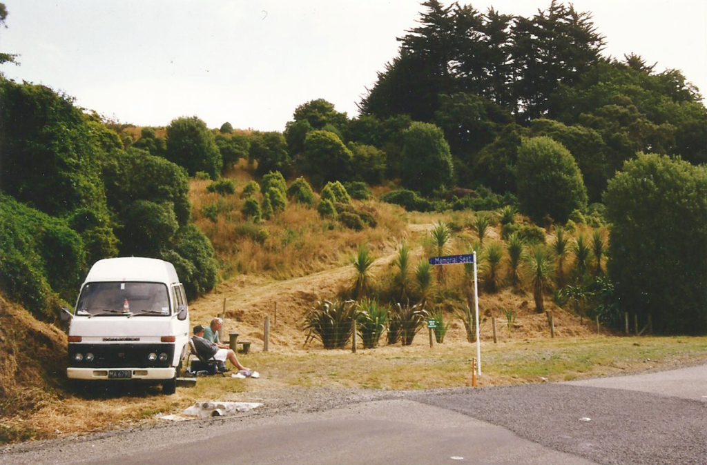
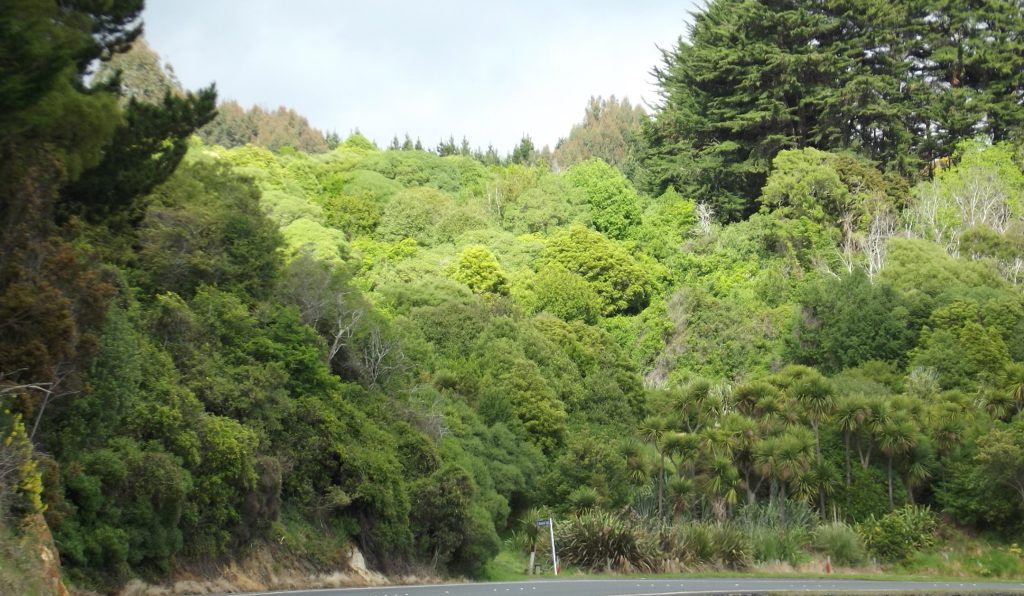
When the Peninsula wastewater was diverted from being discharged into the Harbour, the site of the Broad Bay pumping and treatment station at the bottom of Camp Street was sold. However, the land adjacent had two still-moving erosion areas that affected the road below which meant that the section was not suitable for building and had to be retained by the DCC. They stabilised the slips, (which still must have the sumps cleaned out annually), and STOP took on a Management Agreement to revegetate the area in 1990. This site on the edge of Portobello Road between Camp Sreet and King George Street was seen as a means of publicising the effectiveness of native bush revegetation. It has since been transformed from almost bare paddock with gorse, broom, and hawthorn to a patch of native bush that serves as a picnic and recreation area, with a loop walk that is popular with dog walkers.
3. The Young Covenant behind Podocarp Ridge
In 2008 Alister Young’s bush remnant, also behind Broad Bay – beyond Roebuck Rise – was finally ratified as a DOC Covenant although it had been approved in 2003. In December 2018 it was transferred to the DCC by Alister as a land swap to gain an access corridor from Frances Street for another part of his land. The DCC subsequently transferred the land to become part of the area managed by the Hereweka Harbour Cone Management Trust to be managed alongside the “Future Forest” in the Smiths Creek Catchment, accessed from the end of Bacon Street.
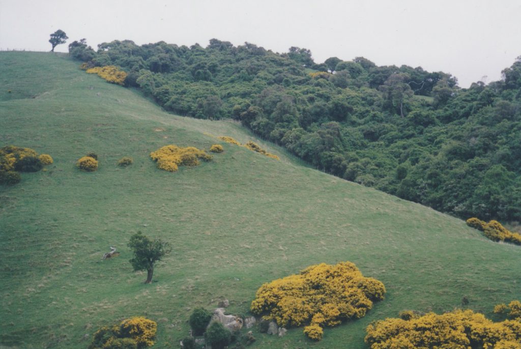
4. Hereweka Harbour Cone Block including Smiths Creek Catchment
In 2007 STOP initiated a successful campaign to persuade the Dunedin City Council (DCC) to purchase the Akapatiki Block Farm. If this had not happened, there was the potential to legally subdivide into over 12 lifestyle blocks, including three titles that went horizontally across Hereweka Harbour Cone, with the likelihood of three house sites with their associated garages and sheds being built on the slopes of the iconic landscape feature.
STOP commissioned reports on the various ecological and historic values. The DCC was persuaded to purchase the 328ha property in 2008. Although initially there were attempts to on-sell all or part of the block, the area is now managed by the Hereweka Harbour Cone Management Trust. It is managed for its historic, ecological and landscape values, with most of it leased for grazing. STOP has a memorandum of understanding with the Management Trust to revegetate the two freshwater catchments on the property.
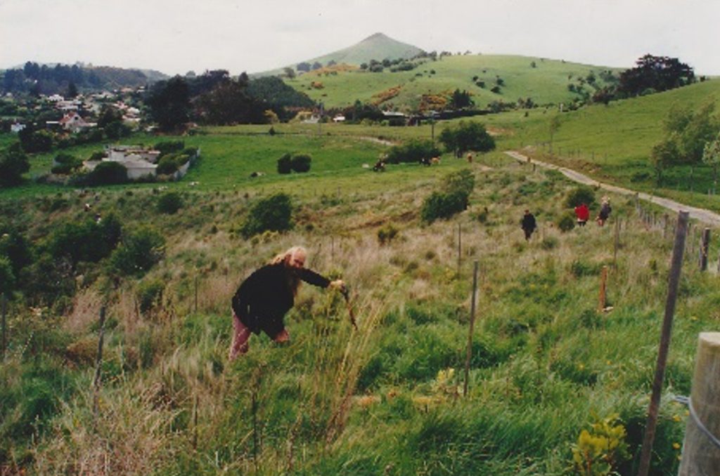
Initially two bush blocks in the Stewarts Creek Catchment on the slopes of Peggys Hill were fenced and revegetated, but from 2012 fencing of blocks within the Smiths Creek Catchment began to form wide riparian strips along the Creek, and up the tributaries, allowing planting of what has become known as “The Future Forest” to begin. The purpose of this planting is to enhance the freshwater habitat of eels, and native fish, so that they can migrate between the freshwater and the saltwater. The aims are to reduce pollution from adjoining grazing animals, to provide shade, and also to reduce sediment by slowing erosion on the steep sides of the catchment, as well as providing carbon offsetting to slow climate change.
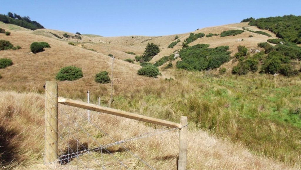
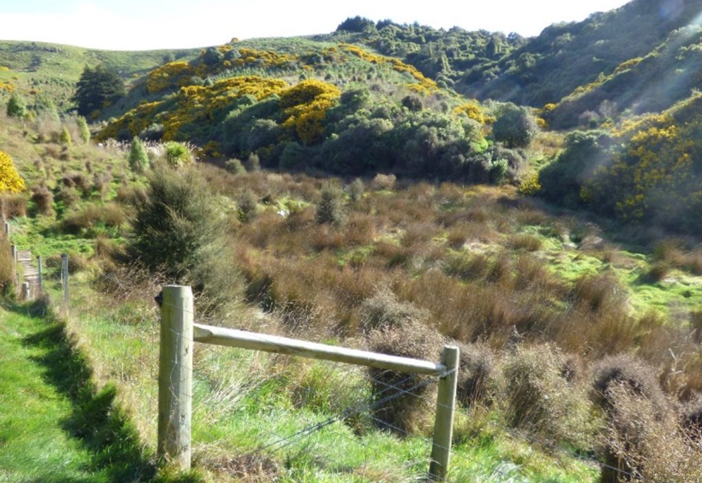
Initially the main creek was fenced, then the steep area between the creek and the Bacon Track, and also the First Tributary (which includes Podocarp Ridge, Macrocarpa Ridge with Peripatus Valley and extensive wetland below and between them, as well as the Lone Broadleaf, the Lone Macrocarpa and the Lone Mahoe which serve as marker points). In 2022 the main part of the second tributary was also fenced with the Lone Pine on one corner.
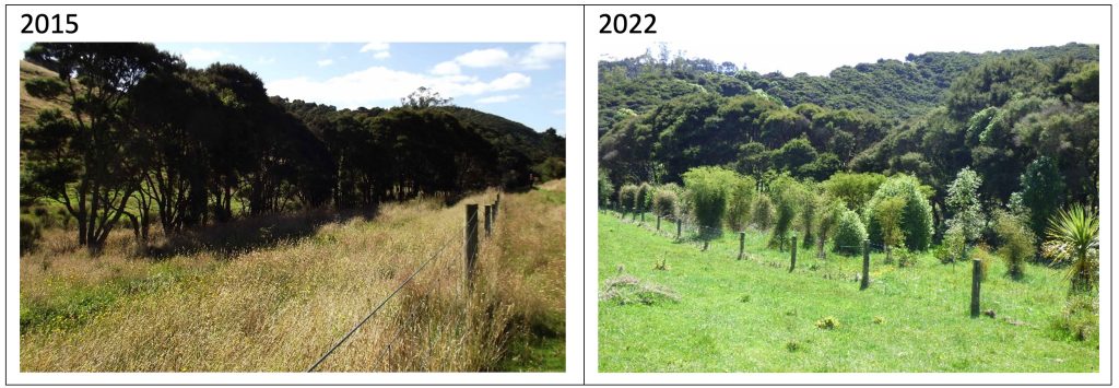
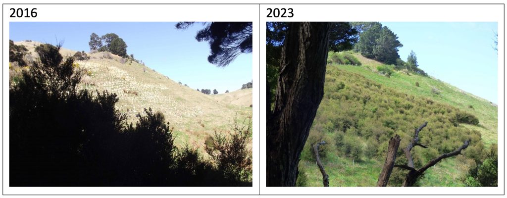
By the spring of 2023, approximately 15 thousand native trees had been planted. The Community Orchard had also been established.
Over 50% of the planting and maintenance is done by the regular twice weekly working bees. The Tuesday group in particular are referred to as “The A Team” turning up regularly and working solidly for about an hour and a half before enjoying morning tea together.
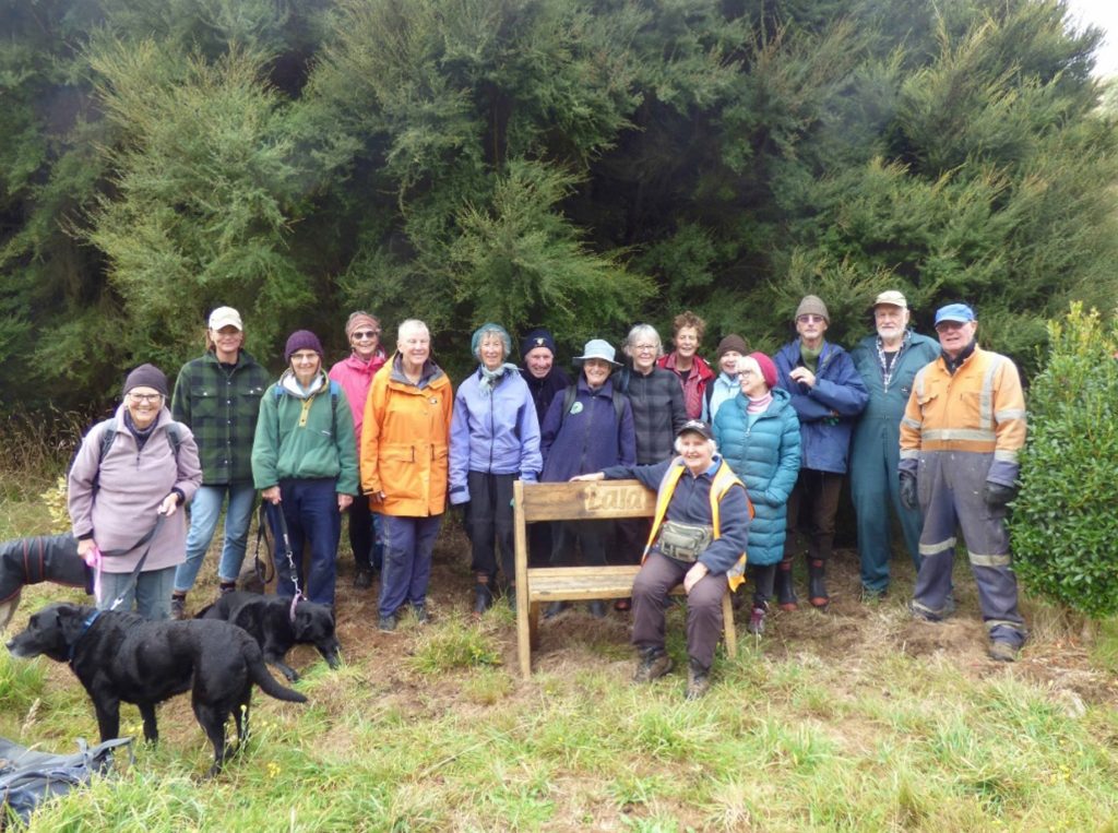
Left to right: Jean McGibbon, Aileen Blake, Lise Wallis, Annie Broadfoot, Jenny Winter, Gwynned Somerville, Mike Conway, Heather Collier, Mary Hammonds, Jackie Fogden, Lala Frazer, (Project Co-ordinator) Ceinwen Simkins, Nyree Macinally, Jonathan Bailey, Ian Frazer, and Vic Mills (builder of seats and signs).
Publications
STOP has published several important booklets that can be used for reference and also serve as fundraisers.
“Otago Peninsula Plants” compiled by Broad Bay botanist, Peter Johnson, was a list of vascular plants of the Peninsula published in 2004. A second edition in 2019; “Otago Peninsula Plants: A revised, annotated list of vascular plants growing in wild places” has three authors – Peter Johnson, John Barkla and David Lyttle. This has proved an important resource when deciding on which species to plant.
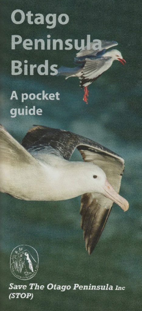
In 2014, another reference book was added; a pocket guide to “Otago Peninsula Birds”.
This contains a comprehensive list of birds that can be seen on or from the Otago Peninsula. It is illustrated by Craig McKenzie’s stunning photographs, with each bird fully described by Richard Schofield. Garden, bush, beach, coastal and marine habitats are illustrated with thumbnail photos for quick ID and a map shows where to find the birds in publicly accessible habitats.
Conclusion
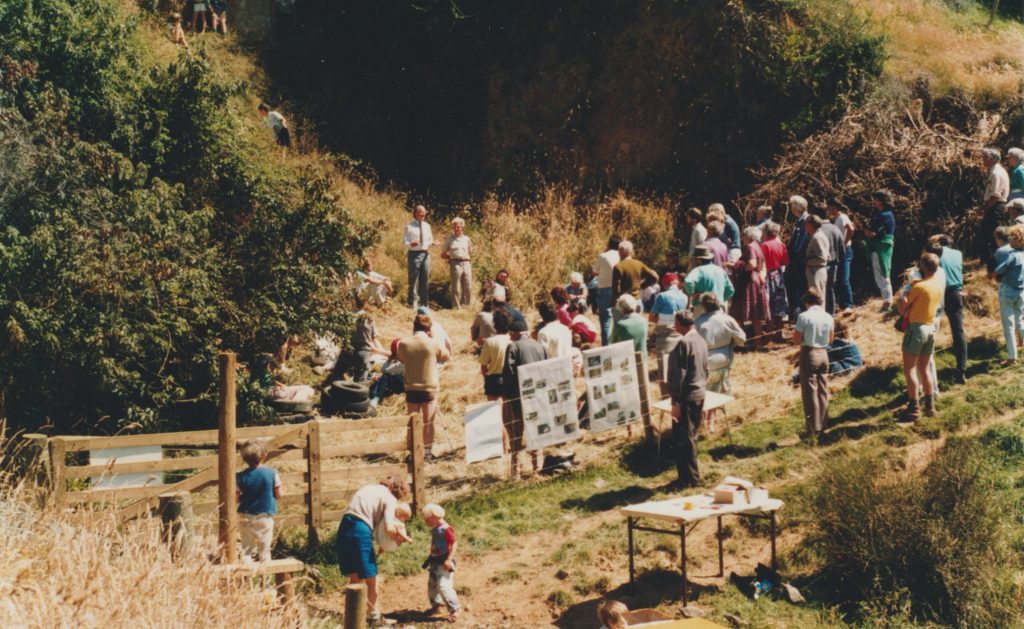
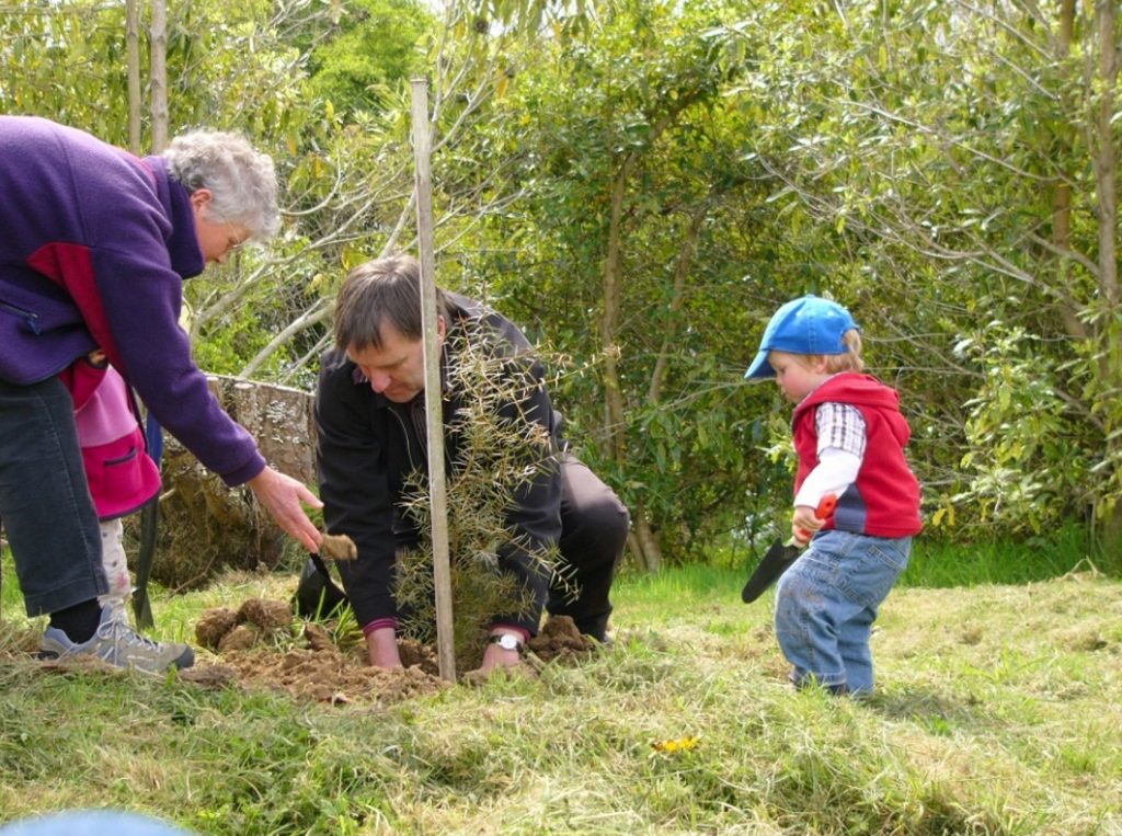
STOP celebrated its 25th anniversary by two of the founding members planting a tree at the Broad Bay Slip Site.
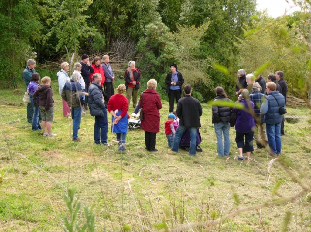
Left to right: Neville Peat, ?, ?, Stella Cullington, Graeme Weir, Jean McGibbon, Frank Pepers, John Langley, Annie Pepers, Jenny Winter, Robin Murray, Sally Stockinger, Christine Johnston, Lala Frazer, Anton Parker, Erin McCafferty (child obscured), Simon Parker, Moira Parker sitting on ground obscured, Kate McCafferty, Helen Clarke (back to camera), Lynn Dowsett (obscured), Ruth McPherson, Rick Good, John Parker, Nigel McPherson, Euan Kennedy, Richard Thompson?, Warren Hurley.
In 2023 STOP is still active on the Otago Peninsula, planting and maintaining native plants; dealing to pest plants that threaten native biodiversity; organising conservation projects that encourage people to volunteer; and submitting on projects that affect the local environment and landscapes.
By Lala Frazer